Offline GPS tracker for boat navigation. GPS Chartplotter for Sailing & boating
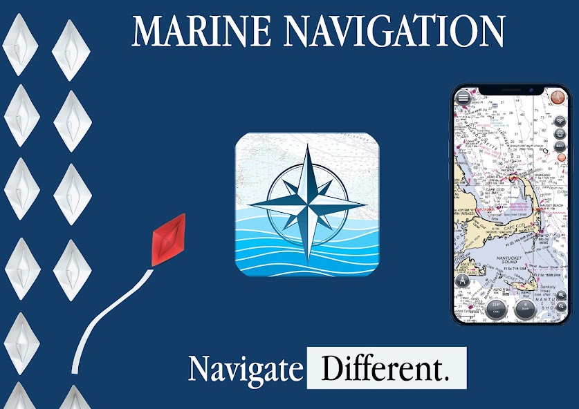
MARINE NAVIGATION
Find your road on the sea! GPS chartplotter for boating.
An easy-to-use offline GPS tracker and route planner featuring worldwide offline maps.
Navigieren Sie mit Ihrem Lieblingsgerät auf der ganzen Welt und verwandeln Sie Ihr Smartphone oder Tablet in einen GPS -Navigator mit einer Offline -Karte, die sich ideal für Meer, Flüsse und Seen, für Bootsfahrer, Fischer und Wassersportarten ideal.
This application is dedicated to the sea and the people who love it and live it with passion.
WHAT MAKES IT A BEST GPS TRACKER OR NAVIGATOR
Offline GPS tracker for boat navigation. GPS Chartplotter for Sailing & boating.
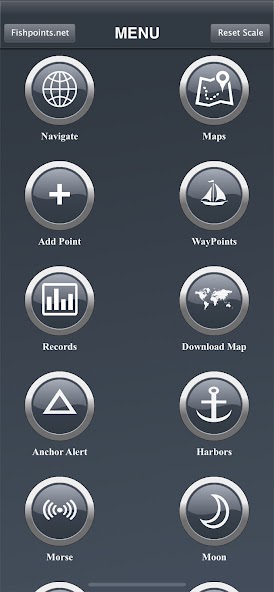
MORSE -Code Im Falle von Gefahr, Ankeralarm, um die Drift des Ankers zu verhindern, die Mondphase, um die Mondphasen während des Tages zu zeigen, Häfen, um die Liste der Ports zu sehen, synchronisieren Wegpunkte, um Backups zu erstellen und aus verschiedenen Geräten auf sie zugreifen zu können.
Sie können auch die Karten und Marine -Diagramme herunterladen, sodass Sie keine aktive Internetverbindung benötigen, wenn es darum geht, Navigation und Routenplanung zu erhalten. If you create a profile, you can save waypoints and routes to access them from different devices. All you have to do is logging in with the same account and enjoy seamless sea GPS navigations.
Egal, egal ob Sie ein professioneller Seemann oder Fischer sind oder Sie sind ein Amateur, der gerne im Meer reist, die Marine Navigation hat Sie versichert. It's a versatile sea navigator app and boating route planner which provides accurate GPS Chartplotter and marine charts.
MAPS OFFLINE:
Download maps or marine charts, you need a select area and application save tile into your device. Navigate on preloaded maps without connection.
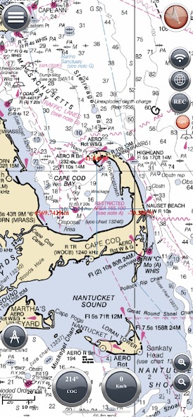
MAPS AND MARINE CHARTS:
MapView: http://www.fishpoints.net/mapsview/
•Nautical maps of the United States of America by NOAA
•Nautical maps of the Mediterranean by NOAA
•Mediterranean RNC
•Nautical maps of the NewZealand by LINZ
•Maps of the world's oceans and coastal areas by ESRI
•World topographic map includes boundaries, cities, water features, ports, physiographic features by ESRI
•Satellite imagery for the world by ESRI
•Maps for the sea, with ports, sea light and more by Open Sea Map
Marine Navigation: GPS Tracker Main Features at a Glance
•Super easy to use GPS tracker tool
•Clean and neat design
•Available in different languages: English, Italian, French, Spanish, Brazilian, Turkish and German,Indonesian
•Download Maps to use in offline mode
•Accurate and detailed GPS Chartplotter, GPS plotter and Marine charts
•Optimized for phones and tablets
•Sync routes and waypoints to access them anywhere from any devices
•Moon phase
•Morsezeichen
•Receive information about speed, direction, time to arrival
•Kompass
•Change Measurement Units: Km, Mi, or Nmi
•Record your route for analyze the data and navigate again
LOCATION PERMISSION
Location information is processed locally on your device, ensuring your privacy.
HELP US
Download Marine Navigation and let us know about any bugs, feature requests or any other suggestions. Stay tuned for more features and options in this GPS tracker app for boating.
WARNUNG
Good seamanship requires the use of official charts. Marine Navigation is for use with other charts and cannot replace official charts. Verwenden Sie auf eigenes Risiko.
LEARN MORE ABOUT FISHPOINTS
http://www.fishpoints.net
IMPORTANT INFORMATION ABOUT SUBSCRIPTIONS
Payment: will be charged to Play Account at confirmation of purchase.
Abonnement: wird automatisch auf demselben Konto erneuert, es sei denn, die automatische Erneuerung wird mindestens 24 Stunden vor dem Ende des aktuellen Zeitraums deaktiviert.
Manage Subscription: inside Account Google Play Settings.
Mehr lesen