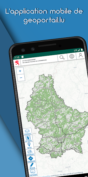
The official mapping app from Luxemburg's national geoportal.
The official mapping app from Luxemburg's national geoportal, developed by the Cadastre & Topography Administration (ACT).
Aplikasi ini memungkinkan Anda untuk melihat peta topografi, foto udara, dan parsel kadaster serta banyak set data menarik lainnya tentang Luksemburg melalui perangkat seluler Anda.
✓SEARCH FOR PLACES: Search for places by names, toponymes, parcel numbers, coordinates etc…
✓Chose among more than 100 different data layers (as available on our website http://map.geoportal.lu)
✓Share your maps
✓ Use maps in offline mode
Lai
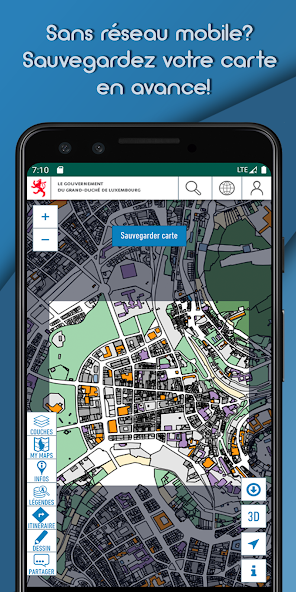
Offline functionality:
Choose a specific zone to download to your device. The active map layers for this area will be available to use even when offline, for example when hiking in areas without network coverage. Fungsionalitas ini juga ideal untuk mengunduh peta kami melalui Wi-Fi di rumah, tanpa menimbulkan biaya pengunduhan data seluler yang berlebihan atau melebihi kuota data Anda.
Lai
✓ ACCESS QUALITY TRAILS
✓VISUALIZE HEIGHT PROFILES
✓ ENJOY A LOT OF OTHER FUNCTIONS
✓ create POIs on the map (thanks to the GPS, by coordinates , eg Geocaching or inventories )
✓ Export GPX/KML files
WARNING: Continued use of GPS running in the background can dramatically decrease battery life. Continued use of maps in online mode may lead to unexpected costs due to high download traffic.
Check our PRIVACY POLICY at:
https://geoportail.lu/en/applications/mobile-apps/privacy-policy
Baca selengkapnya