Your new geo/gps camera plus photo viewer, organizer, and photo collage maker.
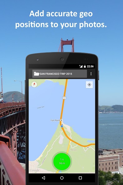
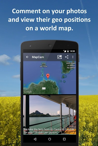
Put an end to imprecise and missing geographical location data (GPS position) in your photos. Organize your photos before taking them by easily selecting a storage folder. Add photo captions to your images. View your photos and their geo positions on a world map. Create impressive geo photo collages and share them with friends.
To do all this, MapCam works together with your favorite camera app and stores additional meta data in your photo files. Isso permite que você, por exemplo, visualize suas fotos e legendas de fotos em um mapa do mundo nos lugares onde você as levou (consulte meus aplicativos Eagleeye e Photomap). In this way, you can go on a trip again by jumping virtually from location to location.
MapCam offers you the following functions:
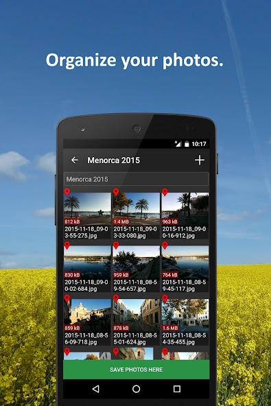
✔ Easily create and select storage folders for your photos before taking them.
✔ Armazenamento automático dos melhores graus disponíveis de latitude/longitude e altitude (em metros acima do nível do mar) nos dados EXIF de seus arquivos de fotos.
✔ Add a descriptive text resp. photo caption to your pictures. The text is saved in the IPTC metadata of your photo file and does not change your photo. Picasa is able to read and show these descriptions on your PC.
✔ Create geo photo collages (map and photos).
✔ Compartilhe suas fotos logo após tomá-las, por exemplo, por e-mail, Facebook, Flickr, Google+, Instagram, MMS, Picasa, Skype, Twitter, Whatsapp, Dropbox etc.
✔ Use existing camera apps. Muitos aplicativos são compatíveis, por exemplo, os mais pré-instalados, câmera MX, cymera, câmera de linha, câmera de pudim, câmera fv-5 lite, câmera360 ultimate etc.
Using MapCam is simple:
1. Click the round button as soon as you are happy with the detected position. The button is light green and big when the current position is precise. It is red and small when the position is imprecise.
2. Tire sua foto: MapCam inicia o aplicativo de câmera padrão ou o seu selecionado e armazena a melhor posição disponível nos dados EXIF do seu arquivo de fotos.
3. Add a descriptive text and share your photo (optional).
Use MapCam if the position and description of photos is important to you. Aqui estão alguns exemplos:
★ When traveling, on vacation, on business trips, when camping, at the beach, at the airport, at the train station, at the museum, etc.
★ Make a note of sites such as real estate, homes, cars, hotels, hostels, restaurants, places of work, schools, parking lots, etc.
★ During sport such as bicycling, rowing, running, jogging, skiing, snowboarding, hiking, exercising, playing football, etc.
★ As a spectator at a special event such as a concert, a festival, a soccer game, a tennis match, etc.
★ As a visitor to a park, flea markets, zoos, amusement parks, Christmas markets, etc.
★ On the weekend family outing, at a party/celebration, at a bar/nightclub, in a club, to record the night life etc.
★ When meeting with friends at the mall, on the playground, while shopping, in a restaurant, etc.
★ On special occasions such as birthdays, weddings, celebrations, parades, etc.
★ In the event of a disaster such as an earthquake, storm surge, flood, tsunami, storm, hurricane, forest fire, etc.
MapCam é interessante para os seguintes grupos ocupacionais: corretores imobiliários, revendedores, artesãos, bombeiros, policiais, trabalhadores da construção civil, motoristas (motoristas de caminhão, motoristas de táxi), gerentes de eventos, silvadores, jardineiros, zeladores, pilotos, soldados, etc.
Leia mais