Trial app for VFR real-time GPS Air Navigation
GPS Air Navigator is an application for VFR Air Navigation :: Air Nav.
Follow us on https://www.facebook.com/gpsairnavigator!
主要功能:
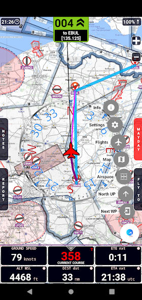
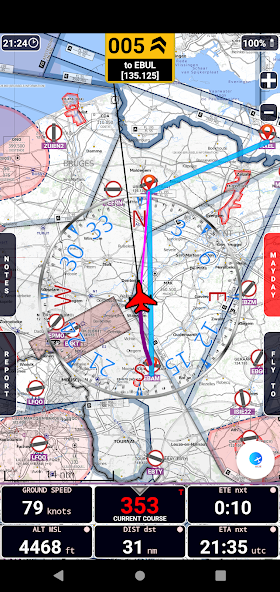
• real-time GPS moving map
• graphical visualization of country air space
• navigation with True or Magnetic North
• High Quality VFR Aeronautical Charts (from Flyermaps.com) for Portugal, Spain, Argentina, Chile, Colombia, Iceland, Uruguay and Venezuela
• free OpenStreetMap maps for all countries
• USA Sectional VFR Charts (generated from FAA VFR Raster Charts)
• WAC and REA Charts from Brazil (thanks to DECEA-Brazil)
•來自荷蘭,波蘭,克羅地亞,捷克共和國,比利時,德國,丹麥,瑞典,瑞典,保加利亞,匈牙利,斯洛文尼亞,奧地利,羅馬尼亞,羅馬尼亞和瑞士的免費OpenFlightMaps圖表
• airspace information for Portugal with daily updates (integrated with FuaFlex service - www.cavok.pt)
• database with more than 56.000 system waypoints
• create and manage your own user waypoints
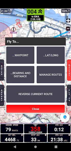
• create and manage your routes and legs
•Mayday按鈕:發送具有當前位置的自動SMS(僅在支持此功能的設備中),並激活路由到最近的路線
• Course with two navigation modes: a) visualization of the course you have to follow to reach the next waypoint or; b)可視化您必須轉動多少度才能到達下一個航路點,而箭頭則表示該點與飛行方向有關的方向是什麼方向
• show real-time flight tracks
• save flight tracks to a GPX file for offline processing (visualize in specific apps or inside the GPS Air Navigator)
• visualize your flight stats and share them on Facebook, e-mail, Instagram and so on
• only one licence needed for all your Android devices
After install, you can try the app with the following limitations:
• you can save only two user waypoints;
• the app closes after 15 minutes of usage.
If you like GPS Air Navigator , you can buy a licence using the button Buy inside the app, to use it without limitations.
Enjoy GPS Air Navigator !
閱讀更多信息